A. Subway: Map and Brief Instruction-Metropolitan
Transit Authority
This is the MTA (Metropolitan Transportation
Authority) New York City Subway Map. New York boasts one of the most
accessible subway systems in the world. The system covers five boroughs
of the City that is Manhattan, Bronx, Brooklyn, Queens, and Staten
Island. The entire system consists of many subway lines labeled by
numerical numbers as letters. This on-line map is a 150
KB PDF file. It will take a few seconds to minutes to download depending
on your Internet network conditions. Once you have downloaded the map you
can view it with different scales as permitted by your browser. The
map is in color and the subway lines are color coded. This PDF file
is not suitable for printing on a PC printer. Please note that, except solely for your own personal
and non-commercial use, no part of these maps may be copied or used
without the prior written permission of the Metropolitan Transportation
Authority. You can write to or call ( This links
to MTA phone directory, For example for ordering maps, 1-718-694-4903
and 1-718-694-5560 Fax) MTA to request a paper copy of the subway
map. The New York Subway is one of the most cost effective public transportation
systems.
You may also visit the on-line interactive
subway map where you can click on any station on the map to link
to information about the lines serving it. In case the map link is
changed by the MTA, you can visit MTA's main website to find it.
See also the detailed map (in PDF format for download) showing Lower Manhattan
bus and subway access. This map is especially useful if you like
to interchange subway and bus or take a combination service to get
to your destiny. The Manhattan Bus of the New York Bus System will
be introduced in the next section.
B. Manhattan Bus Map and Instruction
- New York City Transit
New York City also has a very extensive
bus system serving the five boroughs. This map in PDF format is 293
KB which will take a little longer to download than the subway map.
The map is also in color with bus routes color coded and named with
Mxx where xx is one or two digit number. Obviously M stands for Manhattan.
Q stands for Queens, B for Brooklyn, Bx for Bronx and S for Staten
Island. To find bus maps for the other boroughs, click here. Again,
you may need to consult the Lower Manhattan
bus and subway access map to determine how you may make interchanges
between subways and buses.
C. MTA Lower Manhattan Map
- Metropolitan Transit Authority
Lower Manhattan is different from mid-town
and up-town Manhattan in that its streets are not on a rectangular
grid system. You do need a good street map to find your way around.
If you know the street name, you can always go to MAPQUEST
to print a local map.
However, the MTA's Lower Manhattan is a PDF file of 178 KB which can
be downloaded in just a few second. The advantage of this map is that
it is a single map that can be viewed in different scale as permitted
by your browser. Starting from a 50%, you will have a bird's eye view
of the Lower Manhattan. At 100%, you can see how various public transportations
(subways, Buses and Railroads) are connected. At 150%, you can see
the names and locations of all major subway stations and the subway
lines. At 200%, you will be able to see the names of most streets
and superimposed street and subway map clearly. At 400%, many of the
landmarks, for example, hospitals and police stations are well indicated
on the map. At 800% or 1600%, you probably will get only diminishing
returns.
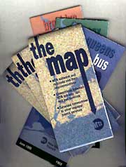
The following picture and statement is the
standard statement MTA has on their on-line map website. We quote
it here so the users will not abuse the intellectual property law
concerning copy righted materials. If the above PDF maps are stored
on this CD, browsing is far more rapid and efficient.
However, this can only be done with MTA's written permission. We apologize
that we did not have the time to obtain the written permission before
publishing this CD.
(Please note that, except solely for
your own personal and non-commercial use, no part of these maps may
be copied or used without the prior written permission of the Metropolitan
Transportation Authority.)
D. NJ Path Map and Brief
Instruction
This is a small PDF map with 45.3
KB. hence it can be downloaded rather quickly. It shows the PATH connection
between New Jersey and Manhattan New York. It shows train stop locations
and their railroad connections. The PATH connects between Newark New
jersey to Penn Station on 33rd Street in Manhattan. There is connection
to Newark Airport at Newark and there are connections to Long Island
Railroad and Amtrak trains at the Penn Station. These connections
help people to get into New York and to Lower Manhattan easily.
E. Ferry
Html Page and Link
As a port and an island, Manhattan
offers ferry for transportation as well as for sight-seeing. This
web link gives information on the ferry run by the Department of Transportation
and a number of private ferries. The pages contain general information
and regulations about riding the ferry as well as a search facility for ferry schedules
by destination or by ferry operator. Don't be surprised if you hear
a steam-boat whistle signaling departure while using the back button
to return to the main page of this website, it is just from a virtual
boat you are seeing on the page.
F. Road Access MAP and
Instruction
If you prefer driving or
you just wanted to experience how New Yorkers drive, you might need
to consult this web page about road access conditions or regulations.
The road access through roads, bridges and tunnels to Manhattan is described on this web page. Of course you may want to tune to the
traffic report which is discussed next.
G. Commuter Links to Traffic Reports
This web link reports traffic
conditions in major cities. New York is listed at the top of the page.
Click New York you will have traffic reports displayed in a scrolling
bulleting format. Any major road condition will be reported here.
You have the financial district, the village and the China Town
which seem always to be challenging motorists. So do consult the reports
before you venture Downtown.
H. Directions to
NYC Chinatown
New York China Town is the biggest
china town in the world. With hundreds (or is it a thousand no one seems
to know for sure) of restaurants and many unique shops, China Town
draws a great number of visitors and tourists. China Town is also
notorious for its parking and driving challenges. We highly recommend
using public transportation or walking to get around China Town.
Big Apple Greeter

Downtown has always been a great attraction as a part of the Big Apple.
Big Apple Greeter founded
by Ms Lynn Brooks offers a greeter service to out of town visitors
with a personal introduction and guide to New York neighborhoods.
Lower Manhattan is one of the few neighborhoods in the City that is
not lined with streets in a checker board pattern. It will be a great
challenge to anyone visiting Downtown for the first time to find his or her
way around. However, if you were smart to call BigAppleGreeter and
reserve a personal guide, then you would be thankful to your greeter
who could lead you to some off-beaten tracks for new and interesting
discoveries. You may bring your findings in the virtual tour you took
in Chapter 2 to ask
the greeter to take you there.
For more Information,
please call 212-669-8159 by
using CodecPhone.
If your PC is
not installed with CodecPhone, you may install a copy by following
the procedure described in CodecPhone Installation.
Free Wall Street Walking
Tour
Downtown is one of the few regions in the City that is not on a grid
system. One of the best ways to orient yourself to the winding streets
of Downtown is to take a leisurely walk. The Wall Street Walking Tour is
a free, 90 minute walk. Given twice weekly, this guided tour explores
the vivid history of downtown and reveals the amazing architecture of
our first national capital, birthplace of immigrants and the world's
center of finance. Stops include the New York Stock Exchange, Trinity
Church, Federal Hall National Monument and numerous other historic sites.
The Wall Street Walking Tour is co-sponsored by the Downtown Alliance
and Delta Air Lines. You may want to take our virtual tour on this CD
first to find the spots that interest you and then book a Wall Street
Walking Tour when you visit new York to see the real place. Wouldn't
that be fun?!
| Date: |
Every Thursday and Saturday, rain or shine |
| Time: |
Noon |
| Place: |
Meet on the steps of the US Custom House at One Bowling Green |
| Cost: |
Free |
For more information, please call (212) 606-4064
by using CodecPhone.
If your PC is
not installed with CodecPhone, you may install a copy by following
the procedure described in CodecPhone Installation.